


Smartphone version | Open manual slider
Operational forecasts of Icelandic dust
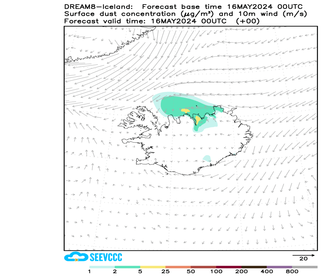
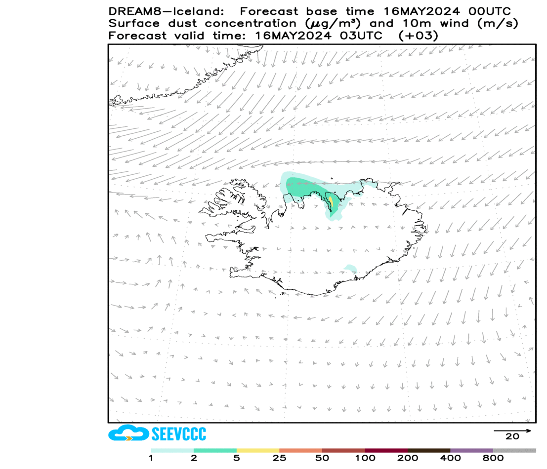
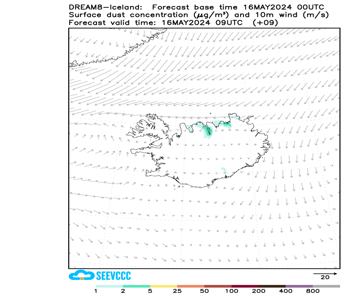
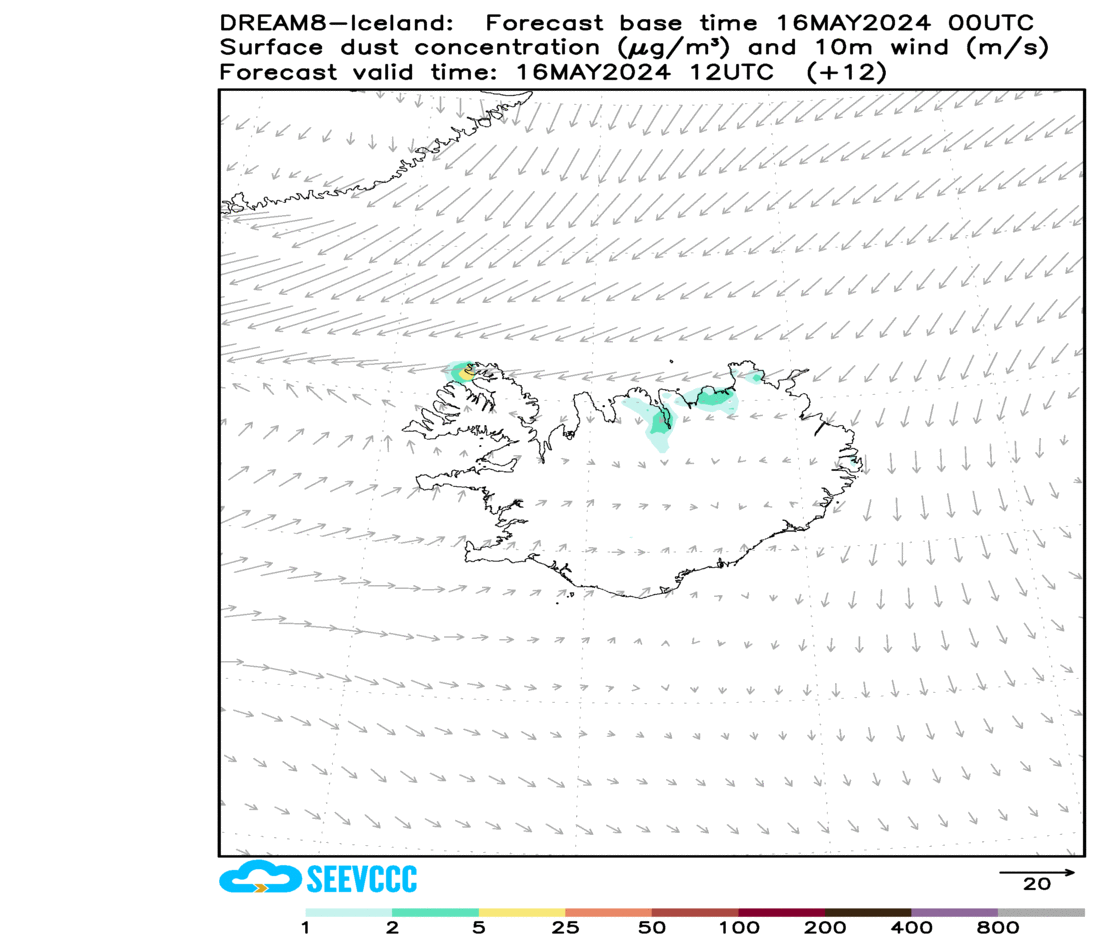
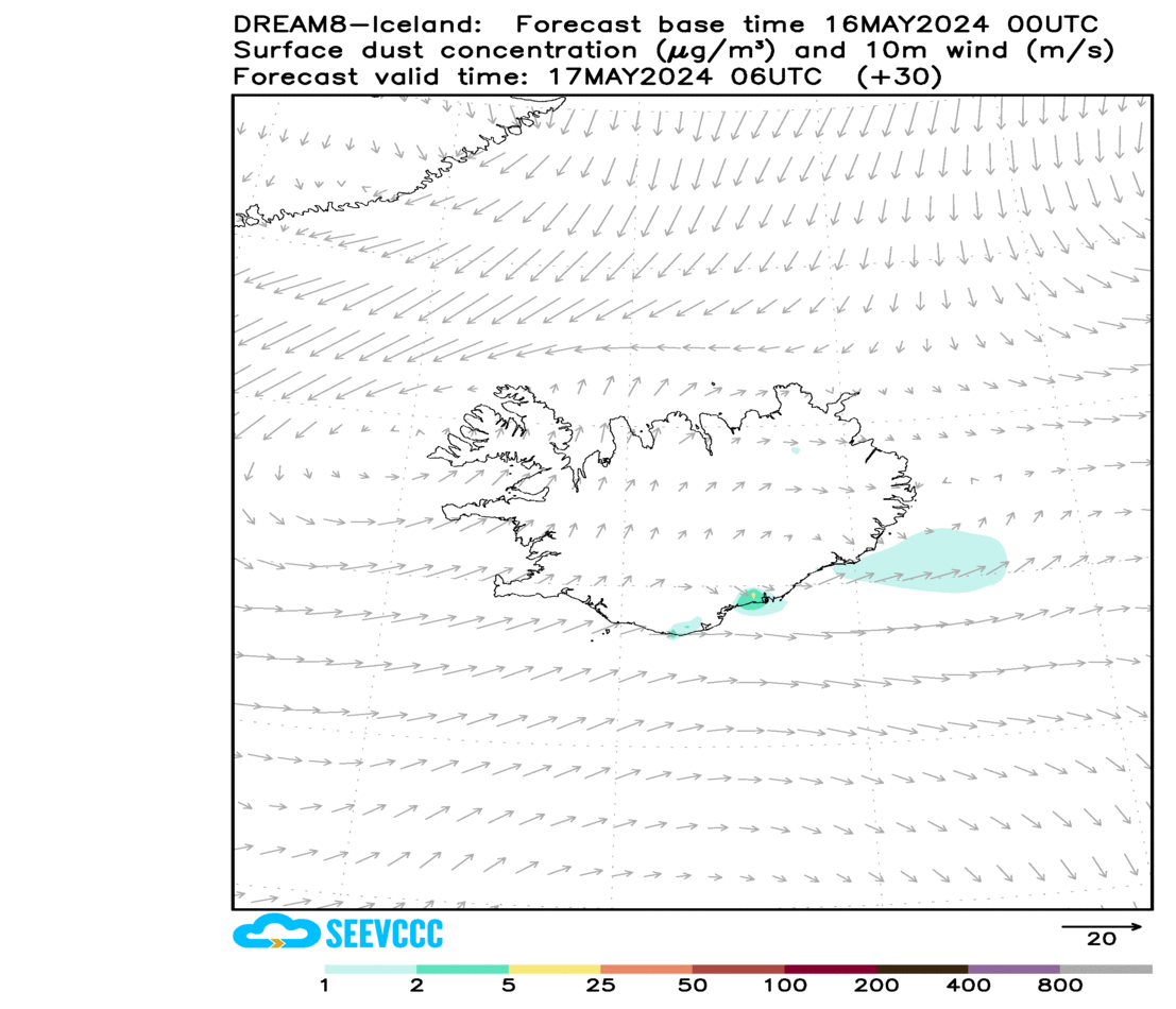
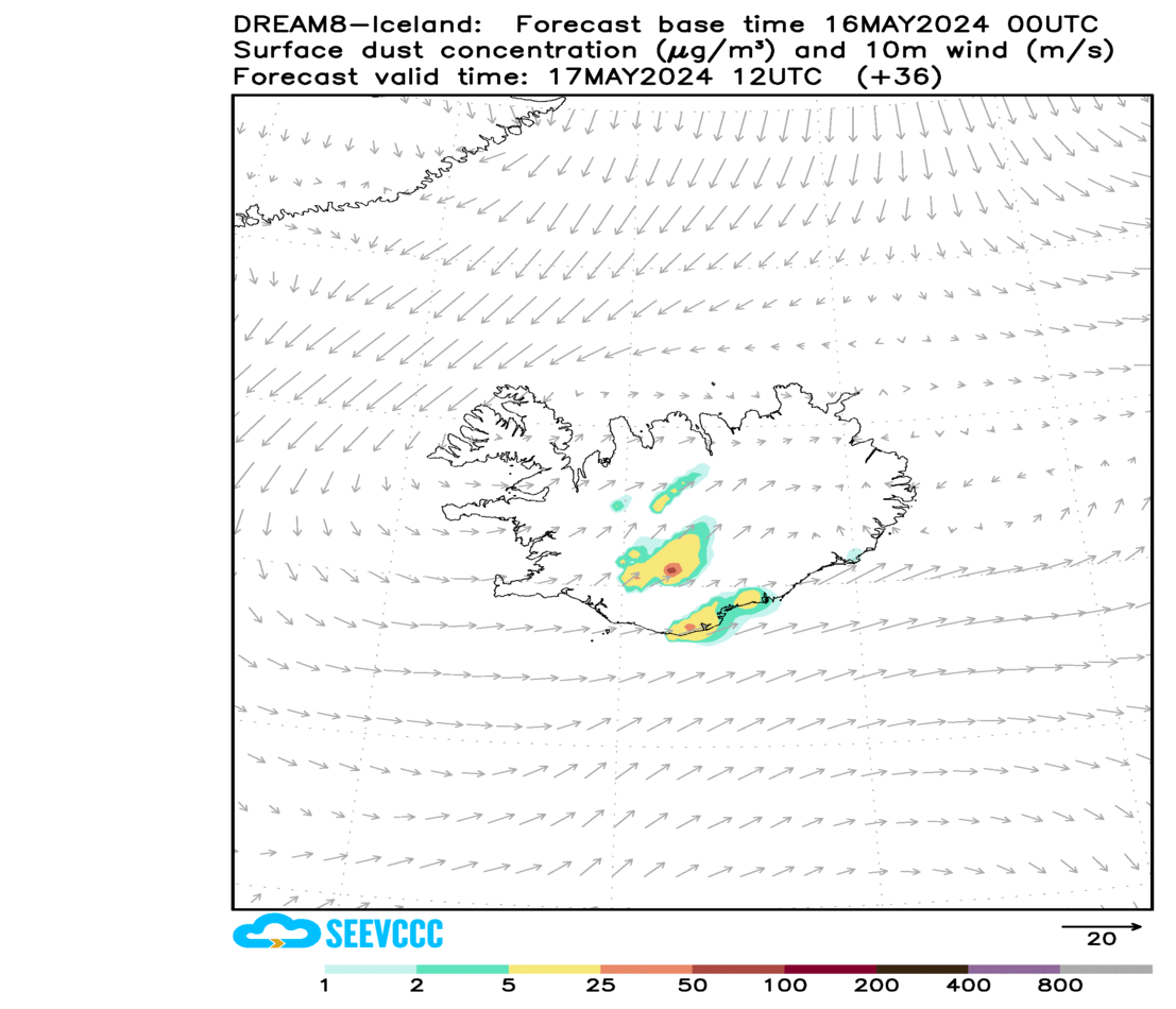
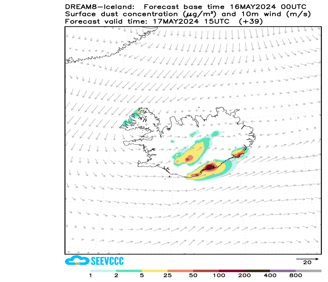
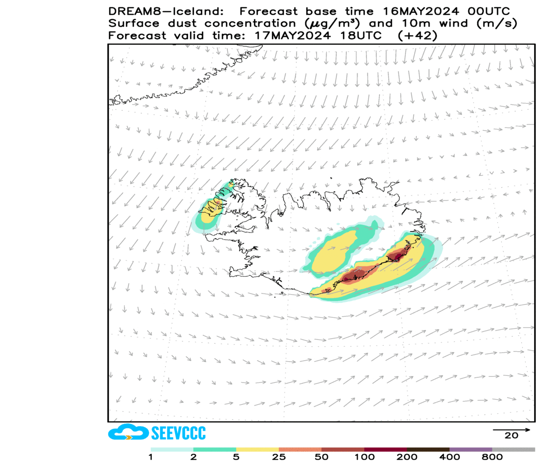
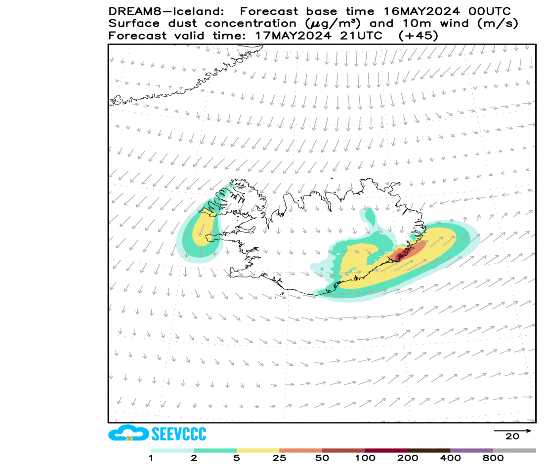
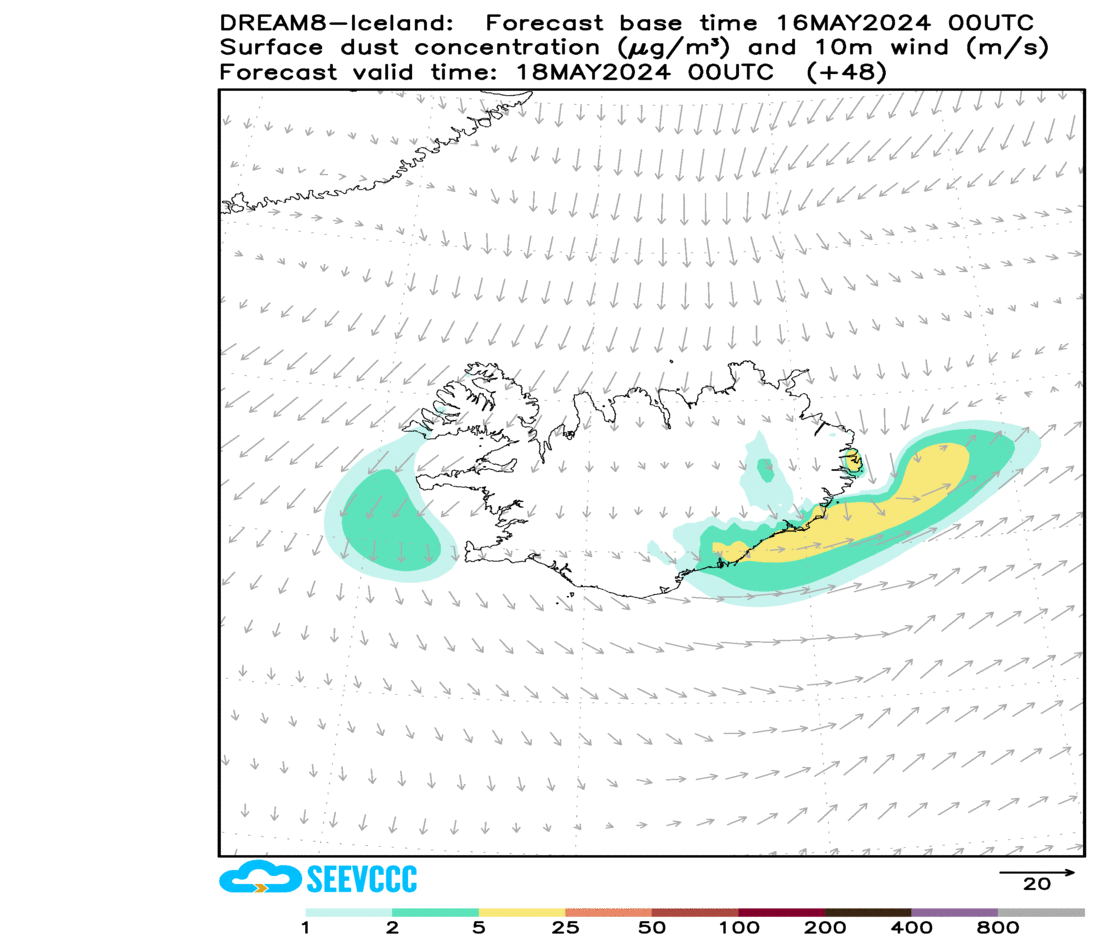
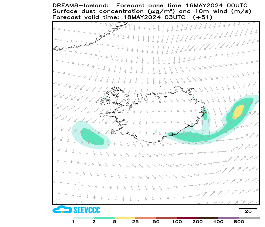
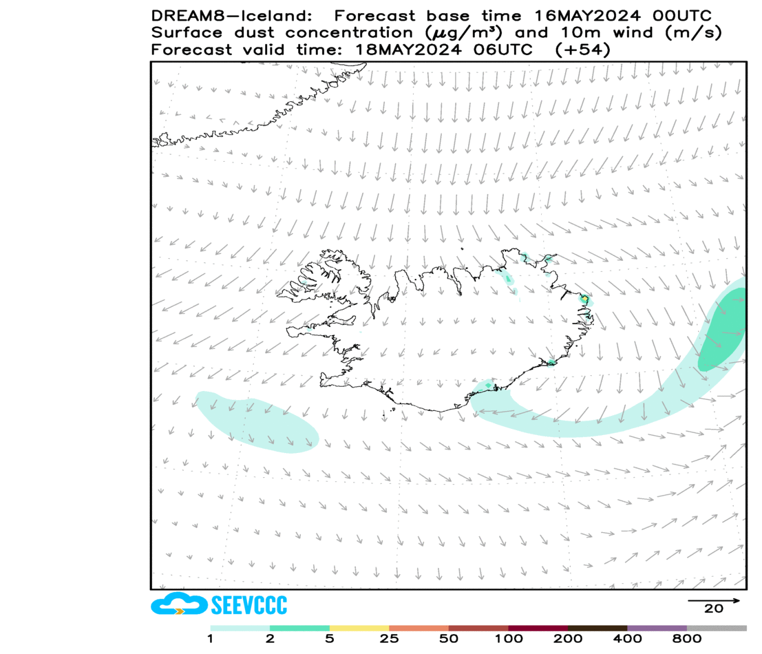
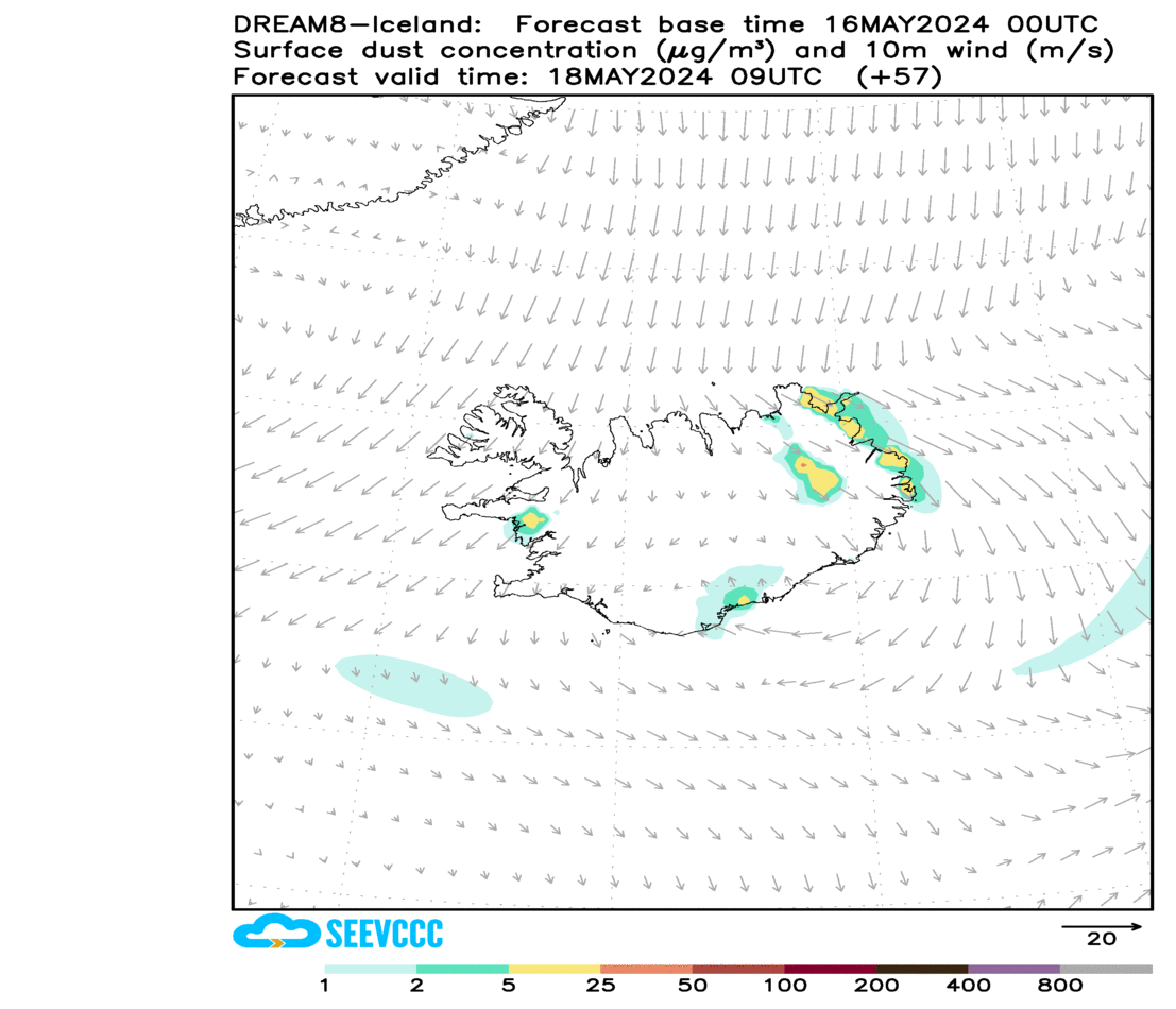
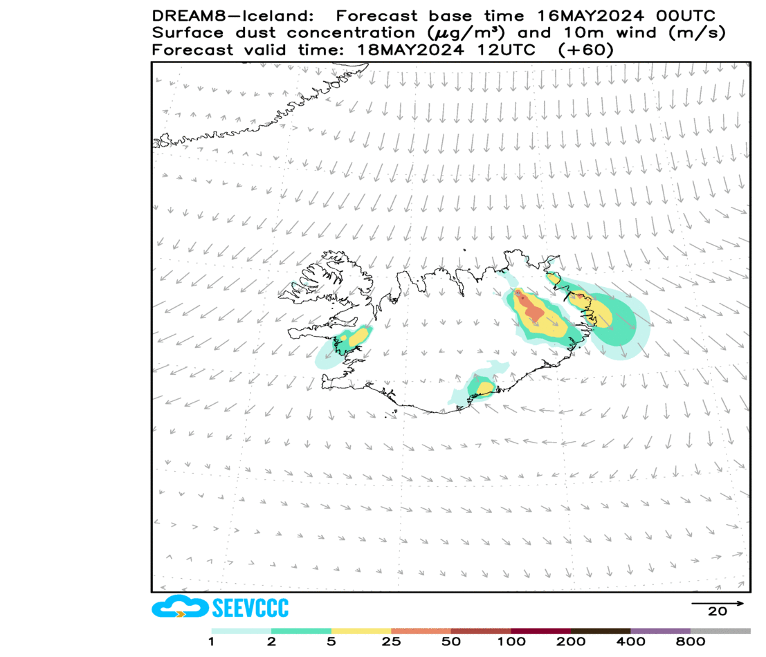
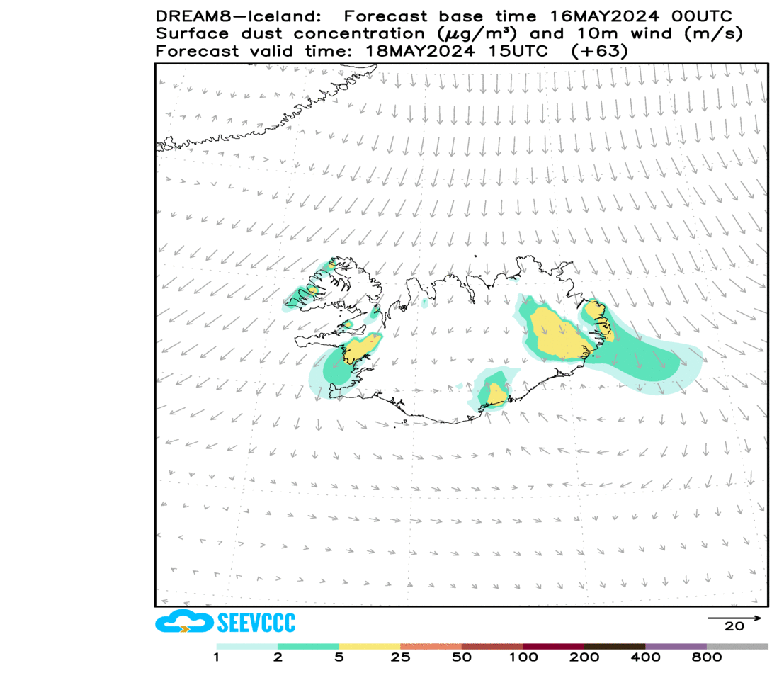
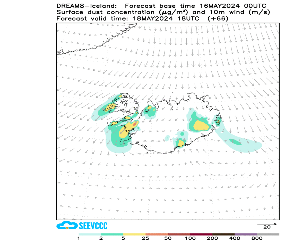
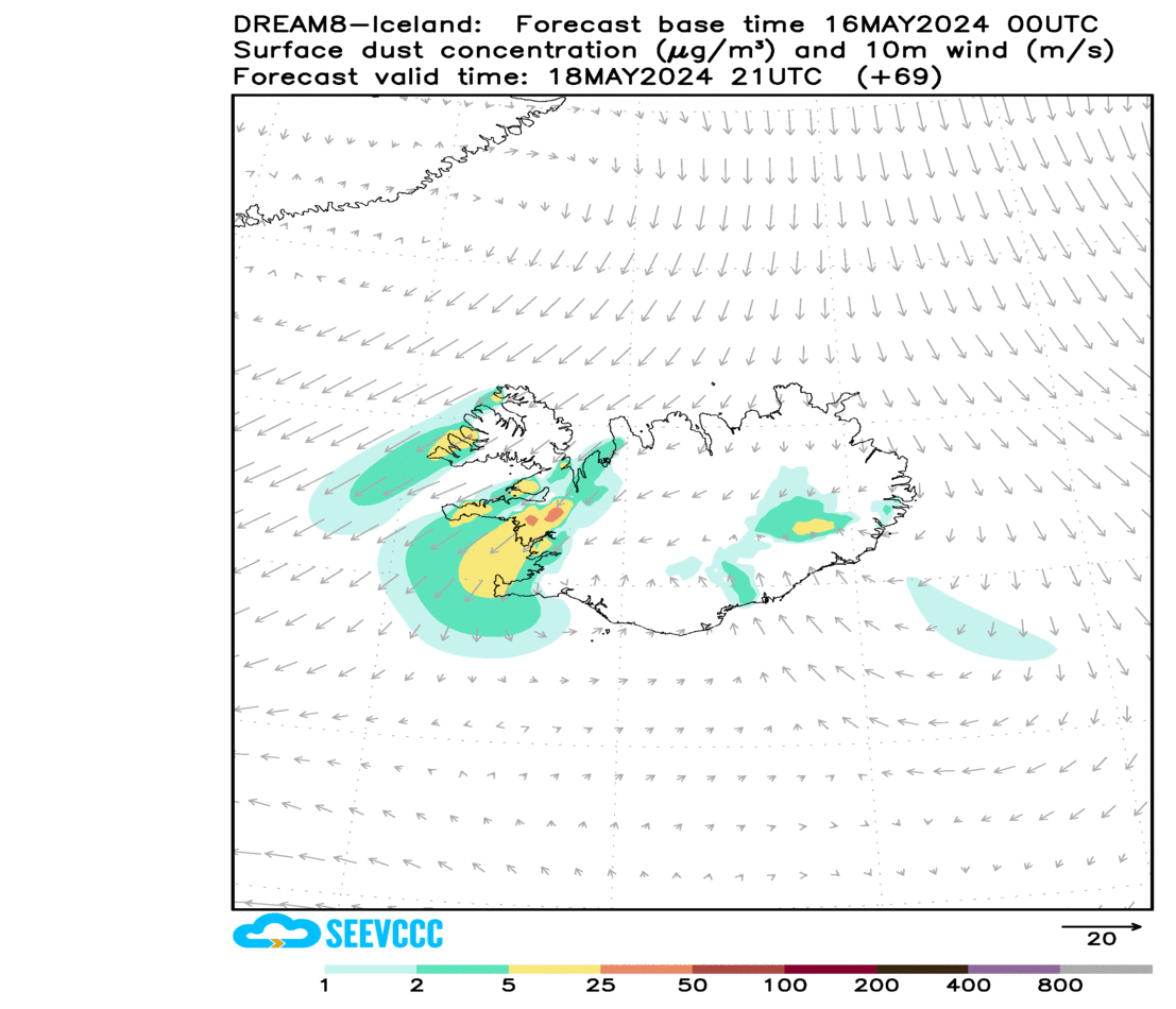
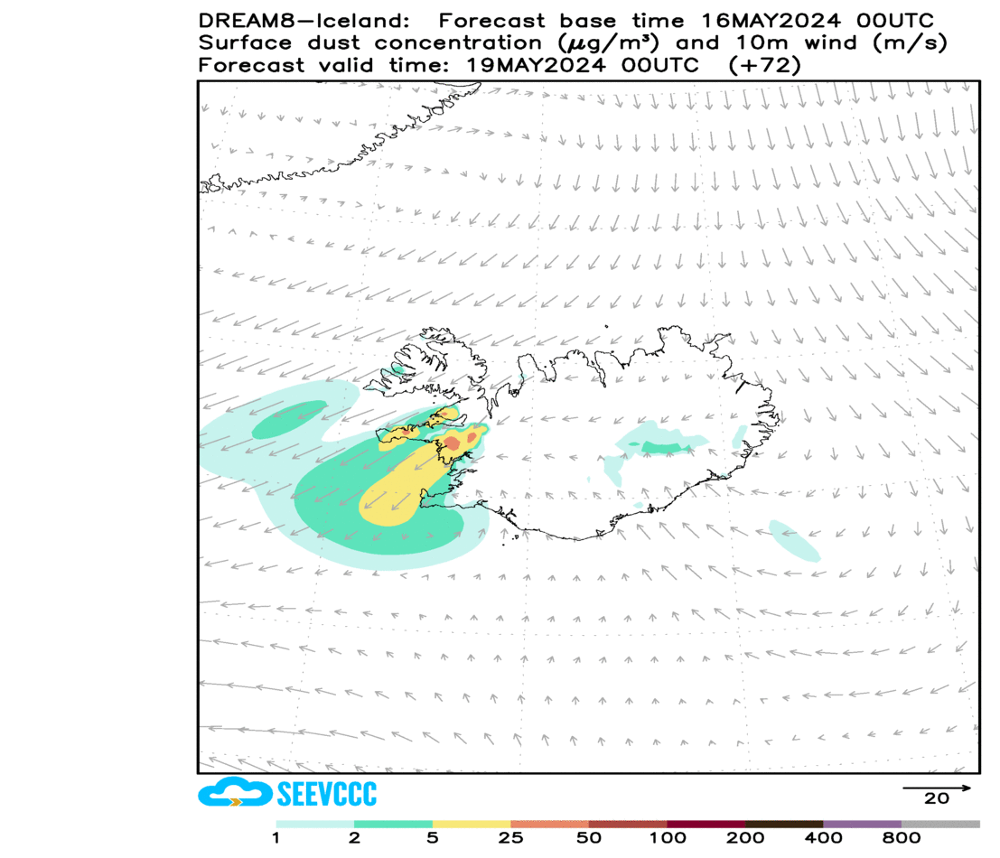
Iceland is active desert where frequent dust storms occur all year-long. Dust storms reduce visibility and they are dangerous to your health. The most dangerous areas for the traveller are around the most active dust hot spots between Hvolsvöllur-Vík-Skaftafell and Egillstaðir-Mývatn, but dust storms can appear also anywhere between Hvolsvöllur and Reykjavík. Several car accidents are reported due to sand storms in Iceland annually.
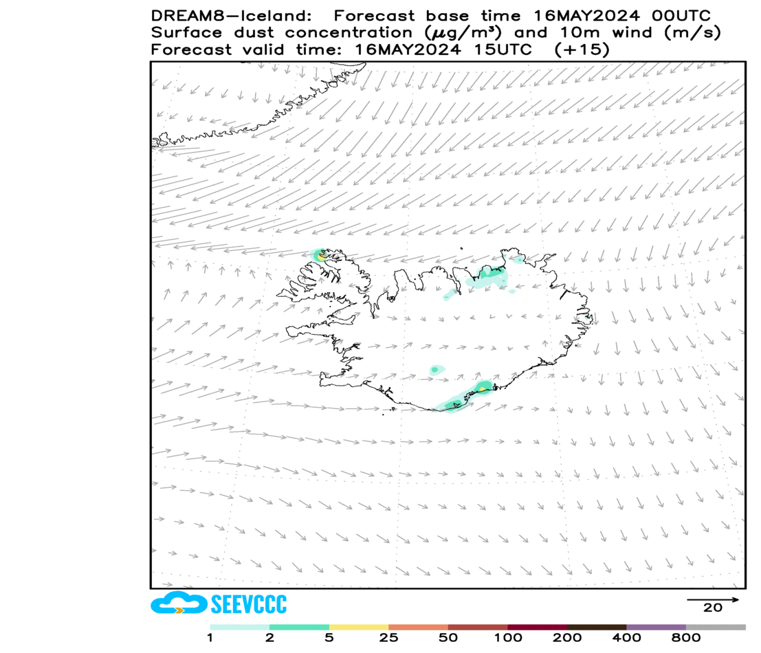
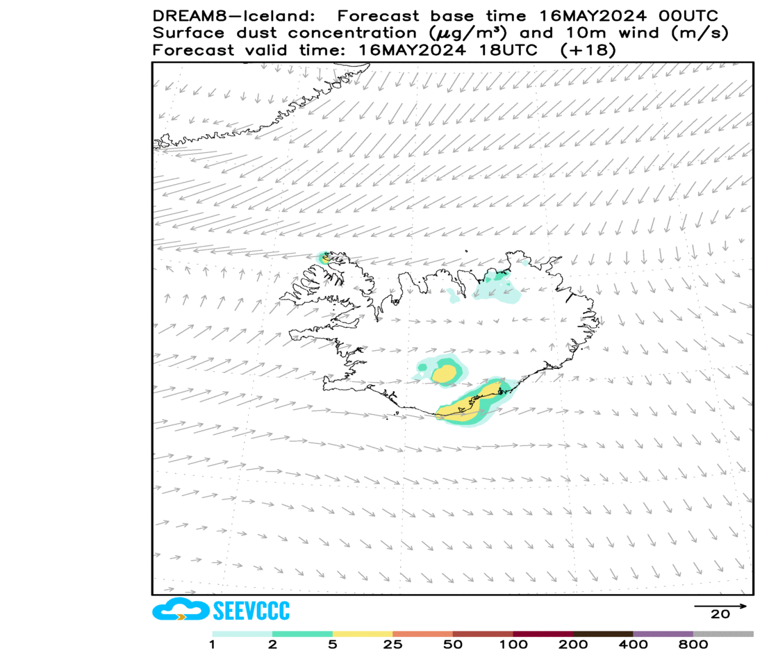
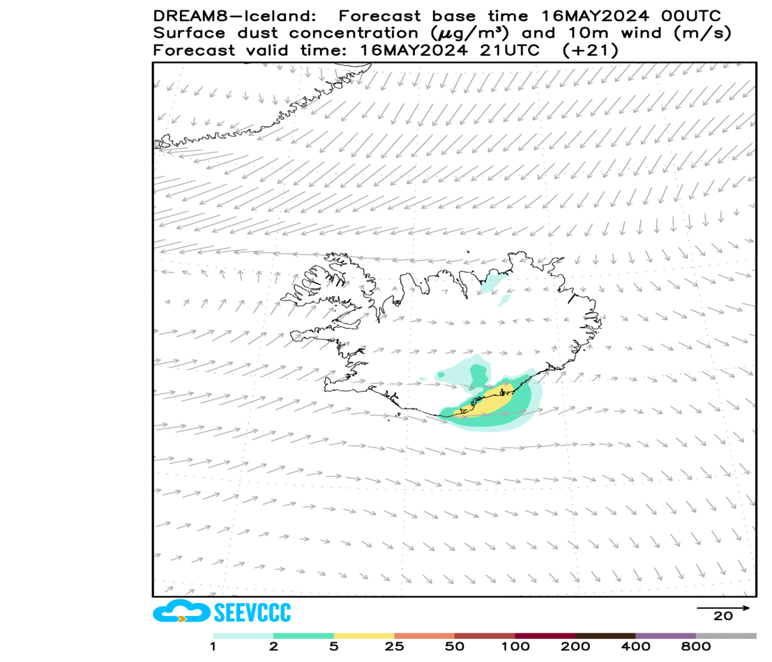
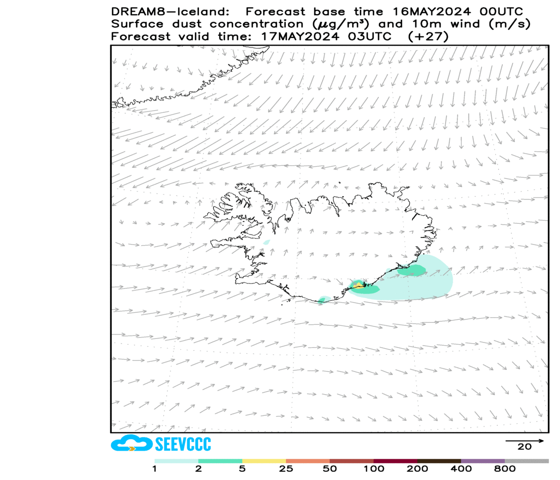
Check here the today´s dust forecast for Iceland for next 72-hrs. The map shows how near-surface dust concentration and wind change every 3 hours. If the colour range is in yellow-orange-brown, you can expect moderate-severe dust storm.
The forecast is made by the advanced prediction model DREAM-ICELAND (1, 2) developed through collaborative work between the Republic Hydrometeorological Service of Serbia, Agricultural University of Iceland and Czech University of Life Sciences. This work is supported by the WMO SDS-WAS and EU COST inDust Action projects and the IceDust Association (available publications on Icelandic dust storms).


References
1. Cvetkovic, B., S. Petkovic, P. Dagsson Waldhauserová, Ó. Arnalds, et al., 2022. Fully dynamic numerical prediction model for dispersion of Icelandic mineral dust. Atmosphere 13(9), 1345.
2. Nickovic, S. et al., 2001. A model for prediction of desert dust cycle in the atmosphere. J Geophys. Res. 106, 18113-18130.
Disclaimer. This information can be used only for non-commercial purposes.